Know The Project
Know the project
About the Oxbow lands
At Walton, we see the demand for strong and sustainable communities that provide new housing, workplace and commercial opportunities within the greater Calgary region. The lands purchased by Walton at the east end of Dunbow Road adjacent to the Bow River offer the potential for implementation of a sustainable community.
The Oxbow lands will be developed to support a comprehensively planned community that will provide residents with a diversity of amenities, open spaces and housing options within a neighbourhood village setting.
The Oxbow Area Structure Plan (ASP) will guide the development of the Oxbow lands. We will work closely with our neighbours to ensure that the amenities, services, and housing options will compliment and contribute to the growth of the community and surrounding region for future generations.
Site Context
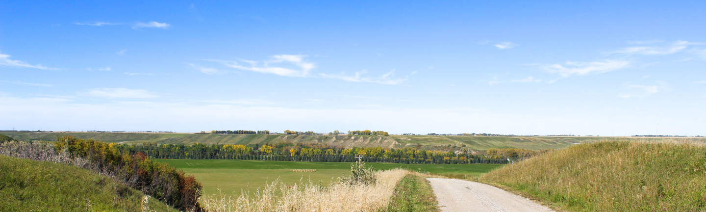
Located at the east end of Dunbow Road, the Oxbow lands are within the community of Davisburg and Foothills County. The lands are northwest of the confluence of the Bow and Highwood Rivers and in proximity to the City of Calgary, physically separated by the Bow River and being some 9 km via the major road network from the City boundary.
To the west, the lands are bound by 88th Street E and to the north by the Cottonwood Golf & Country Club, and the Bow River. Walton’s land ownership area bounds the plan to the east. To the south of the subject lands is Dunbow Road and a mix of agricultural uses and country residential lots and homes.
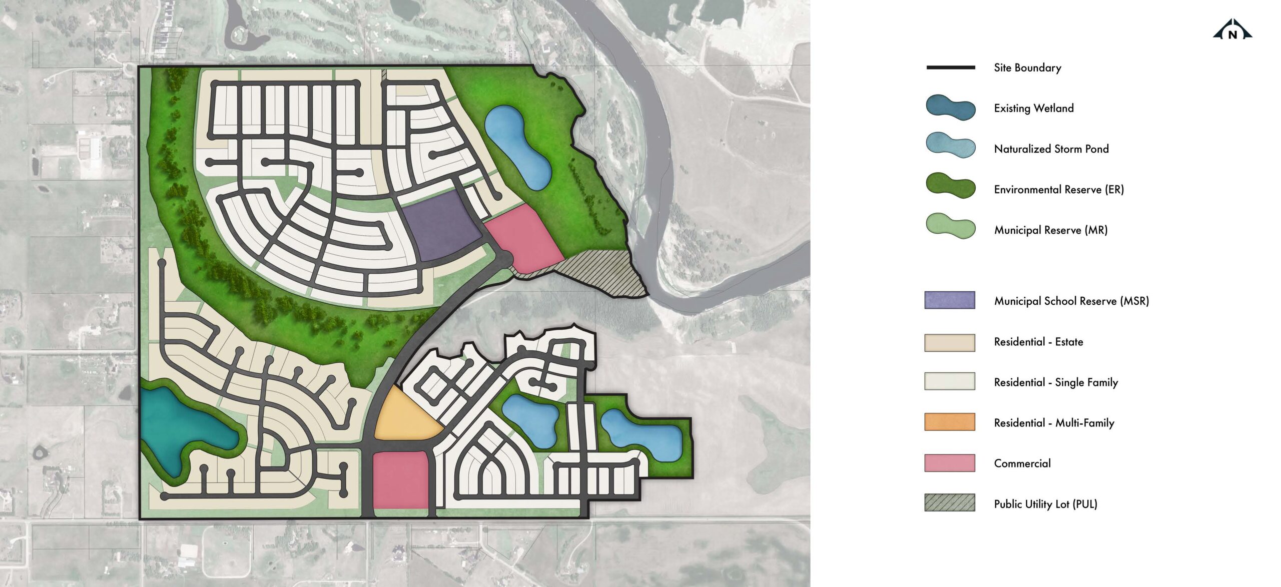
The Oxbow lands are currently designated under the Agricultural and Country Residential land use district. As part of the Oxbow Area Structure Plan (ASP) we will submit a new land use concept to support the development of a complete community.
An Updated Concept Plan
We have made changes to the Oxbow ASP concept plan to address key areas of feedback we received. The design revisions to the updated Oxbow ASP and the inclusion of additional economic, social, and environmental sustainability focused policy, will provide the planning framework for the Oxbow community.
Click here for our spring 2024 Information Session boards for additional information about the updated Oxbow ASP.
The updates to the Oxbow ASP include, but are not limited to:
• Reducing the boundary of the updated Oxbow ASP to 640 acres to conform with the Calgary Metropolitan Region Board’s (CMRB) policy and design direction for Hamlet Growth Areas.
• Revising the Oxbow ASP concept plan to reflect an increased development setback from the Bow River's edge based on hydrological modelling using the 1:200 flood inundation event from draft Provincial flood mapping data.
• Re-assessing the design of the riverfront area and the nature of amenities to mitigate the potential for Bow River park area becoming a regional attraction and thereby potentially creating a series of enforcement and traffic externalities for the County.
• Naturalizing the river area to promote biophysical function, habitat creation, and wildlife activities.
• Converting previously proposed stormwater ponds to reconstructed wetlands enhancing the integration between the Oxbow community design and nature.
• Enhanced policy provisions and design considerations relating to environmental sustainability (e.g., encouraging green energy, water conservation, dark sky objectives, etc.).
• Increased the range of lot sizes (i.e., upwards of ½ acre), with a significant proportion of the single family lots and mixed use nodes having direct access to open space supporting a rural village feel along with enhanced lifestyle and mobility options.
The anticipated time horizon for the buildout of the Oxbow community is forecast to be 15-20 years. This time horizon is based on the phased approval, design, and implementation process and with consideration to current anticipated growth and market conditions.
Project Principles
We worked closely with community members and Foothills County to understand what already makes Davisburg a great community. We listened and learned from our neighbours and developed six guiding principles for the Oxbow ASP. These project principles remain as the foundation for the updated Oxbow community design.

A Distinctive Community

Share the Land

Connect to Nature

Embrace the Past

Stewardship

Respectful Community Design
Why "Oxbow"?
The community name Oxbow is inspired by the geography and farming roots of the lands.
The development of Oxbow embraces the evolution of the lands while also acknowledging the importance and influence of the past.

An "Oxbow lake" begins to take shape when a river creates a wide meander. Over time, the meander is cut off from the river and forms an oxbow lake. Similarly, the Oxbow lands are bound by the Bow River to the north, where a sharp bend in the river has formed. Given enough time, it is likely than an oxbow lake would form where the current river channel flows north of the lands.

"Oxbow" is also a term for the "bowed' or U-shaped piece of metal placed around oxen when ploughing field or carrying heavy cargo. The oxbow is connected to a yoke, allowing the animals to work together and share the load.